
Blog
Tags: Archeology, Conservation, Books, Cornwall, Archives, History, Collections
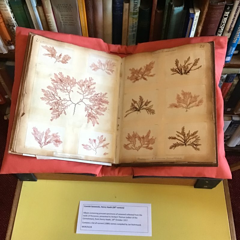
Tales from the Archive: Henry Heath and the pressed Seaweed album.
Our volunteers have been delving into the collections again, looking for the stories behind some of our archival treasures.
Kay Line volunteers in our Photographic Archive. She was fascinated by our album of seaweeds, collected and pressed from Mounts Bay in the late nineteenth and early twentieth centuries. We know that the album was a gift from a local gent called Henry Heath, to the editor of the Cornishman newspaper, Herbert Thomas.
Kay has undertaken some deep research to try to find the reason behind this extraordinary, precious gift – click on this link to read her blog:
Henry Heath & the Seaweed Book
Thanks to Kay for all her work!
An Exploration into west Cornwall’s Maritime People and Working Lives, using the Photo Archive collection, by Samuel Hill
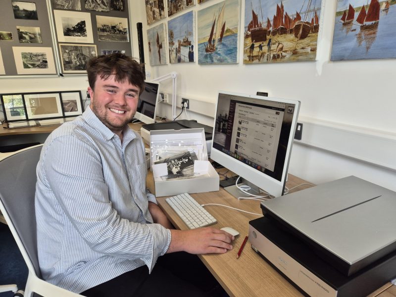
Our library was fortunate, and delighted, to host Sam Hill on a three month internship, where he worked in our Photo Archive.
As well as no less than seven blogs you can find links to below, and delivering an entertaining talk about his time with us and the discoveries he made in the collections, Sam has also written a longer academic paper about our collections, which we will add to our archive. This article explores West Cornwall’s maritime people and their working lives between 1865 and 1935, using images from our Photo Archive collections.
You can click on this link to read Sam’s article here: Exploring West Cornwall’s maritime people, by Sam Hill August 2026
Use these links to read Sam’s blogs:
Maritime Communities and meeting the Creatures of the Deep
Penzance Then and Now Part One: Market Jew Street and Chapel Street
Penzance Then and Now Part Two: Promenade and Alexandra Terrace
Penzance Then and Now Part Three: Alverton.
Penzance Then and Now Part Four: Pubs, Taverns and Inns
We are so grateful to Sam for all of his hard work and great company while he was with us, and we wish him all the best for the future.
Our next display: Extraordinary Animals – Conrad Gesner’s Historia Animalium
The third display in our new exhibition case on the first floor takes you back to the 17th century, and a very special natural history book…
Conrad Gesner (1516–1565), Historia Animalium, 2nd edition, 1617-1620. Volumes 1 and 2. (E596)
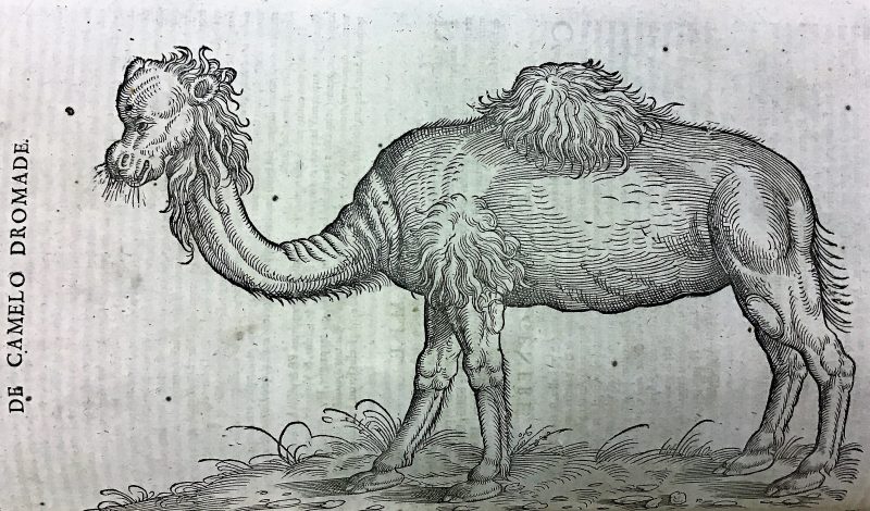
This large volume comprises two of a set of five written by Swiss naturalist Conrad Gesner. Our library holds later editions of Volumes I and II, published between 1617 and 1620, the originals were published between 1551 and 1558. Through these books, Gesner became the first naturalist to attempt to describe all the known animals (and some unknown) of the world, even though he would not have seen the majority of them in the flesh.
Born in Zurich in 1516, Gesner was one of many children, and was sent to spend his childhood in the care of a grand-uncle, where Gesner’s keen interest in natural history began. He was awarded a scholarship to study in Bourges University in France, in 1533, later taught Greek in Lausanne, and then Aristotelian philosophy back in Zurich, where he spent much of the remainder of his life.
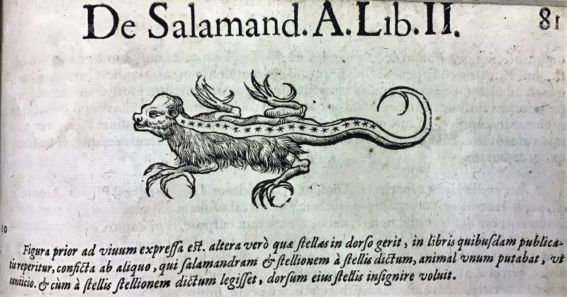
Gesner could be described as an ‘armchair naturalist’, working primarily from his study and acquiring his knowledge from reading and correspondence, as well as with actual animals and animal specimens. He used the literature of early naturalists such as Pliny and Aristotle for many descriptions, and significantly, he tried to gather as much physical evidence as he could by using traveller’s descriptions and specimens. Gesner amassed such a collection of zoological specimens he created a museum in house for them. Despite his best efforts for accuracy, his methodology saw a few ‘interesting’ descriptions and illustrations of animals, including a unicorn and even a hydra.
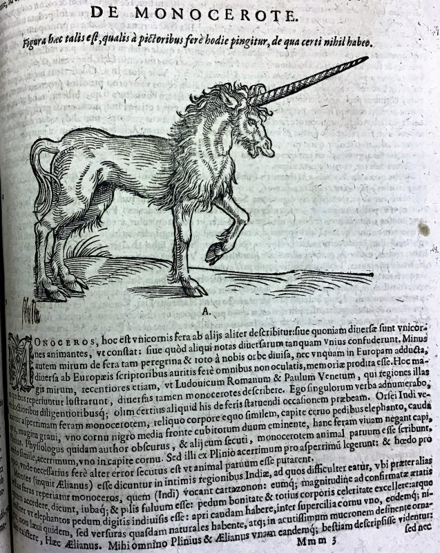
The writing of Historia Animalium proved a monumental task, comprising more than 4,500 pages. The first two volumes describe mammals, the third birds, the fourth aquatic mammals, and the fifth, published posthumously, describes serpents. It was published in the two recognised scientific languages of the day – Latin and Greek.
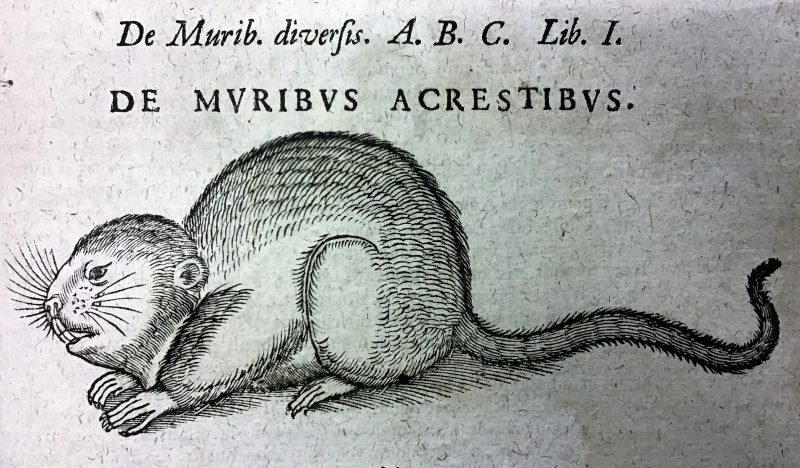
Gesner’s work was groundbreaking and forged a new path in scientific description. Each species in his work is described in great detail, broken down into eight topics, including all the known names of the animal in living and dead languages, the animal’s physical description, geographical range, uses in medicine, and even any mentions in history and literature. Most animals have an accompanying woodcut to illustrate them.
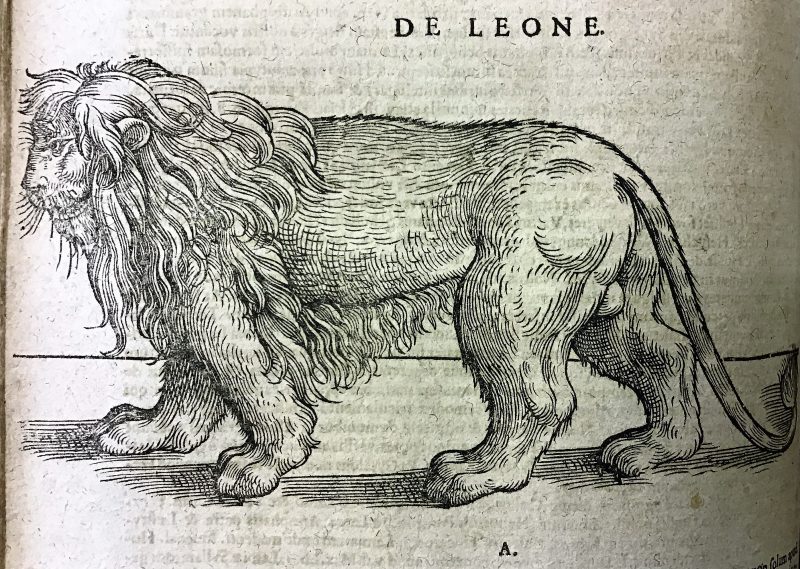
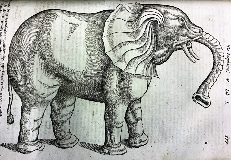
Sadly, Conrad Gesner was to die from the plague at the age of just 49. He left an important legacy to our understanding of the natural world and scientific research.
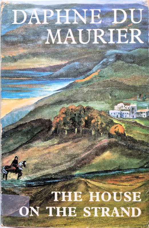
Fact and Fiction in Daphne du Maurier’s The House on the Strand – an article by Jane Prince
Our brilliant Library Volunteer, Jane Prince, has written this fascinating article about Daphne du Maurier and her novel The House On The Strand. Jane has explored how du Maurier used actual Cornish history in her writing, and also deviated from it for literary purposes. We are delighted to share her paper here.

Daphne du Maurier precedes her novel The House on the Strand by acknowledging the help given to her in her research by a list of local Cornish experts but states that the novel itself is a blend of fact and fiction. I thought it would be interesting to examine how closely du Maurier followed Cornish history and where and how she manipulated facts and events for literary purposes, and also how far she was justified in shredding the reputations of various historical persons.
The action of the novel is centred on the house Kilmarth to which du Maurier moved in June 1969 when the lease of Menabilly, rented from the Rashleigh family who also owned Kilmarth, came to an end. In fact du Maurier’s husband, Sir Frederick Browning, had signed the lease of Kilmarth four years earlier just before his own death. The House on the Strand was first published in 1969, the interim period since the signing of the lease having been spent by du Maurier in renovating Kilmarth and researching its history.[1]
Du Maurier was fascinated to learn that the house had fourteenth century origins and to hear of the existence of a Roger Kylmerth living at that time, and intrigued by the discovery in the old kitchen premises in the basement of the remains of a laboratory which had been set up by the previous tenant, Professor Charles Singer. On 30th November 1967, du Maurier wrote to her friend Oriel Malet that she had found out that Professor Singer and his wife ‘used to know about alchemy’ and speculated about the embryos in bottles left behind. What if the Singers had made queer discoveries and what if they had found some secret way of going back to the past? Du Maurier had begun to envisage the ‘whole countryside in a fourteenth-century way, and the sea roaring up past Par, and touching Tywardreath and the Priory above, and my Roger Kylmerth man being rather wicked’.
She had also found a well and shocked her builder Mr Pascoe with a suggestion that germs from the Black Death might have polluted it.[2]
In fact, there was nothing sinister about either the laboratory or Professor and Mrs Singer who were respected medical and scientific historians. The American poet May Sarton stayed with the Singers at Kilmarth in the spring of 1936 and described being met at Par station by Charles Singer ‘a beneficent Teddy bear, with curly white hair and a shrewd, kindly smile’. During her stay, May Sarton was conducted through a jungle of overgrown trees and bushes to stare through the windows of Menabilly, just as Daphne du Maurier and her sister Angela were to do ten years later, marking the start of Daphne’s obsession with Menabilly.[3] The laboratory at Kilmarth had been set up by the professor during the Second World War in order to teach practical biology to the pupils of the King’s School, Canterbury, who had been evacuated to Cornwall. The Singers had moved to Kilmarth in 1934 for the sake of the professor’s health (he suffered from cardiac asthma) and from then on he lectured at University College London for two terms per year, spending the rest of his time in Cornwall.[4] Dorothea Singer was an academic in her own right and, in view of du Maurier’s references to the Black Death, it is interesting to note that Dorothea Singer read a paper on Plague Tractates in March 1916, for the Section of the History of Medicine of the Royal Society of Medicine, where she later served as a council member.[5] In 1950 she published a definitive catalogue of pre-sixteenth century manuscripts concerning plague. The Singers certainly did ‘know about alchemy’: in 1924, 1928, 1930 and 1931 the Union Académique Internationale published the four volumes of Dorothea’s ‘monumental’ catalogue of alchemical manuscripts in the British Isles from Greek, Latin and vernacular manuscripts, demonstrating her immense skill as a paleographer.[6]
As far as Kilmarth House itself is concerned, the descriptions of the interior in The House on the Strand match those described by du Maurier in her autobiography The Rebecca Notebook: a dining room and library on one side of the hall and a long room on the other with French windows opening onto a terrace. The long room was the drawing room in du Maurier’s day but is known as the music room in the novel. Professor Singer used it as a library. According to his obituary, it was seventeen yards long and looked over gardens and fields to St Austell Bay. The professor did not shut himself away to work – house guests and visitors used the room as well with Singer joining in the conversation.[7] Just as in the novel, a former dining room had been transformed into a bright modern kitchen replacing the warren of old kitchen, scullery and laundry in the basement. The cellar walls possibly formed part of the medieval farmhouse, together with the small sunken courtyard outside, where Richard Young finds himself at the end of chapter one, having inadvertently touched Roger Kylmerth and been precipitated back into the twentieth century. Upstairs the principal bedroom, dressing room and bathroom overlooked the sea, enchanting du Maurier in reality and Vita Young in the novel (Chapter seven).[8]
The timeline of the novel follows actual historical events fairly closely. The fourteenth century action begins in November 1328 with the visitation of Bishop Grandisson to Tywardreath Priory, a date confirmed by du Maurier in Enchanted Cornwall and by the Bishop’s registers.[9] The novel ends with the death of Roger Kylmerth of plague in 1348. Although this was the date of the Black Death in Cornwall, the actual date and cause of Roger Kylmerth’s death is pure speculation.
In the novel, du Maurier helpfully reveals her historical sources through the investigations undertaken by Richard Young, the principal character, and his friend the scientist Professor Marcus Lane, owner of Kilmarth which he has lent to Richard, his American wife Vita and his two stepsons for the summer. Marcus Lane has also developed the potion which enables Richard, who has been persuaded to take part in the experiment, to travel back in time to the fourteenth century.
Du Maurier uses the bishop’s visitation to introduce her cast of characters. In the first chapter we meet Roger Kylmerth, steward (according to du Maurier) of the manor of Tywardreath, who provides a link between Kilmarth and Richard Young and the fourteenth century characters. Roger is on his way to the priory at Tywardreath, where an atmosphere of corruption and moral dissolution prevails under the prior who is revealed as a drunken glutton with no authority over his monks and who is anticipating the bishop’s visit with trepidation. We also meet the sinister French monk Jean de Meral who appears to exercise an undue influence over the prior and other monks.
In the following chapter, the important local members of society are assembled to receive the bishop: Henry de Champernoune, lord of the manor of Tywardreath, and his wife Joanna, sister of Sir Otto de Bodrugan, and their son William; Sir Otto de Bodrugan married to Margaret, Henry de Champernoune’s sister, and their son Henry; Sir Oliver de Carminowe and his second wife Isolda (nee Ferrers) and their two children Joanna and Margaret; and Oliver’s brother Sir John de Carminowe, mentioned in the first chapter as a patron of the priory, and his wife Joanna, nee Glyn. (The spelling of names varies in historical records so I have used those which appear in the novel).
Although the principal characters of the fourteenth century were real people, their appearance, relationships, personalities and motivations are where du Maurier deviates from historical fact. All we know of these people are the few facts available in contemporary sources relating to their official positions, manorial tenures and obits.
Du Maurier’s portrait of the prior is rather unfair and she was possibly basing his character on the sixteenth century prior Thomas Colyns, who had a certain unsavoury reputation.[10] Bishop Grandisson’s visitation in 1328 was prompted by a need to enquire into the finances of the priory.
Oliver Dinham had disposed of his rights of patronage over the priory (given to him by Isolda de Cardinham) to Richard, earl of Cornwall in 1270 and the priory’s substantial endowment had gradually been whittled away, partly through sequestrations by the crown to finance conflicts, particularly with France.[11] Prior Philippe had paid a generous subsidy towards Edward I’s campaign in Scotland and while this earned him some recognition from the crown, it also placed a strain on the resources of the priory which went from bad to worse until one of the principal creditors, Sir John de Carminowe, obtained a mandate to seize priory property in recompense. Witnesses favourable to the prior meant that he was maintained in his position by the bishop but with his authority effectively removed. His decisions were subject to a council of which John de Carminowe was a member and who was therefore able to recuperate some of his losses. William de Bouges, prior of Minster, who became prior of Tywardreath after Philippe, was another and also Walter de Kent, rector of Cardinham. The prior was forced to give up the seal of the priory. The community of monks was demoralized by this situation and the prior lost all ability to enforce obedience to the rule of St Benedict.[12]
The location of the priory is not exactly known, as Richard Young learns from the vicar in chapter three, but is thought to be on the site of Newhouse Farm. Leland’s Itinerary of 1533 mentions the tomb of Robert fitzWilliam, grandson of the founder Richard fitzTurold, as being in front of the crucfix in the west part of the nave.[13] The priory was a community of about twelve monks in 1320 and had been endowed with the advowsons and rents of several local churches and chapels as well as other parcels of land and tenements in various areas of Cornwall. The priory was an alien house of the abbey of Saint Serge and Saint Bacchus of Angers, as Richard is told by the vicar, along with the priory of Totnes and the small cell at Minster in Cornwall.[14] The priory buildings included a cloister, chapter house, refectory, dormitory, prior’s chamber, guest hall (uninhabitable by 1339), kitchen and stable. In 1324, an inventory by royal officials listed three beds in the prior’s chamber and six in the monk’s dormitory and included three horses in the stable.[15]
In the first chapter of the novel, Henry de Champernoune is praying in the priory chapel whilst Roger Kylmerth is meeting the prior. Henry is described as lord of the manor but in fact there were two manors of Tywardreath: the priory manor and a lay manor and Henry was lord of the latter. Du Maurier does not distinguish between the two. The possessions of the priory were organized into eight manors of which Tywardreath Prior was one (the prior being lord of the manor) and which included lands, churches and tenements in the areas of Tywardreath, St Austell, St Endellion, St Enoder, Golant, Lanlivery, St Martin-by-Looe, and Menheniot.[16]
It is debatable how much time Henry de Champernoune would have spent at Tywardreath as his principal manors were in Devon at Clist Champernon (Clist St George), and Ilfracombe (now known as Chambercombe Manor) part of the honour of Barnstaple. In the twelfth century, a former
Henry de Champernoune (Campo Arnulphi) held seven fees of Oliver de Tracy, descendent of William de Tracy (a natural son of Henry I) whose son Henry held the honour of Barnstaple, and four fees of Robert fitz Roy of Okehampton, another illegitimate son of Henry I.[17] Isolda de Cardinham was a descendant of the founder of the priory Richard fitzTurold. Her first husband was Thomas de Tracy and the relationship probably explains her sale of Tywardreath to the Champernounes around 1268.[18] She also transferred to them the manors of Penhallam, Trelawne and Ludgvan and the advowson of the church at Jacobstow.
Du Maurier depicts the manor house at Tywardreath as being a simple structure of hall, kitchen, and upper chamber, similar to the fourteenth century manor which still survives as The Old Post Office, Tintagel.[19] She contrasts this unfavourably with Bodrugan (the site of which Richard Long explores in chapter twelve) where Joanna de Champernoune grew up, implying that she must have found Tywardreath a disappointment. In fact, the manor of Bodrugan was held by the Bodrugans of Henry de Champernoune as of his manor of Tywardreath. Joanna and Otto were wards of Henry senior after the death of their father in 1308. Restronguet was probably the most profitable of their several manors although the fact that they were known as ‘de Bodrugan’ indicates that the family was probably first established there.[20] Moreover, the Champernoune’s manor of Penhallam, in the parish of Jacobstow, was a sophisticated stone-built affair with extensive buildings which had been the principal manor of the Cardinhams after the Conquest and which they had greatly enlarged during the thirteenth century.[21] By the beginning of the fourteenth century this manor had been sublet to the Beaupré (Bello Prato) family, so if the Champernounes occupied a smaller manor, it was through choice rather than necessity.[22] However, Henry de Champernoune was interred in the church at Tywardreath in 1329 so presumably he did die at Tywardreath, as in the novel, and his son William certainly did inherit aged eighteen.[23] There was indeed a dispute over Henry’s interment at Tywardreath Priory, as in chapter six, and the removal of his remains forbidden by the bishop (chapter seven).[24]
The incident in chapter twenty-one regarding the penance of Mary, widow of Rosgof, the smith, who is forced to ride on a black ram to church to confess her sin in front of the steward and Joanna de Champernoune (representing her underage son William as lord of the manor) illustrates the importance of manorial custom in deciding property rights, various disputes and wrong-doing. The incident relates to the custom of Free Bench but it is the indignation of Polpey and Trefengy that a custom of the manor of Cardinham should be applied in that of Tywardreath which is interesting. Manorial custom in deciding local matters survived well into the nineteenth century in manorial courts. Jonathan Couch, grandfather of Sir Arthur Quiller-Couch (du Maurier’s mentor and father of her friend Foy) described the court leet of Killigarth manor which features in du Maurier’s novel The King’s General. By the mid 19th century this manor court had been transformed into a more convivial affair held at the Ship Inn, Polperro but followed the ancient practice by which tenants were summoned by the reeve to do ‘suit and service to the lord’ (by then Mr Kendall of Pelynt); the tenants paid their rents and dues (as has just happened in Tywardreath before Mary Rosgof’s penance); a jury was chosen by the steward and an oath administered and ‘the presentment of the jury always began with the preamble “all our ancient customs are good and laudable” ‘. The business of the manor concluded, the squire and steward tactfully departed leaving the rest of the company to enjoy an evening of ‘unrestrained mirth’.[25]
In chapter six of the novel, Joanna de Champernoune, Henry’s wife, appears to act in cahoots with the monk Jean de Meral and they conspire to hasten the death of Henry through the use of herbal medicine concocted by the monk. Bishop Grandisson did not specify Miral’s (de Meral in the novel) faults but referred to a lack of modesty and honesty and called him a ‘diseased sheep’ in danger of infecting the healthy flock in a letter to the abbot of Saint Serge when, after the death of Prior Philippe in May 1333, the bishop took the affairs of the priory firmly into his own hands. Certain monks had been guilty of excesses through dissolute living so the bishop restricted the community to an allowance of eighteen pence per week each for their board and lodging to be held in common and all were to reside under the priory’s roof. He also took the opportunity in 1334 to get rid of two monks sent by the abbot to protect the interests of the mother house and send Jean Miral with them, giving them some money towards travelling expenses. He also appointed his own candidate William de Bouges as prior. The bishop’s actions were part of a general campaign to curb the rights and liberties of foreign religious houses.[26]
Central to the story is the love affair between Joanna de Champernoune’s brother, Otto de Bodrugan, and Isolda, second wife of Oliver de Carminowe. Otto’s background is discussed in chapter nine when he meets at Kilmarth with Geoffrey Lampetho, Henry Trefrengy and others to discuss support for Queen Isabella and her lover Mortimer. Julian Polpey is also mentioned as being amenable. Du Maurier found the names of Lampetho, Trefengy and Polpey in the Lay Subsidy Roll for 1327 and borrowed them for her conspirators. Lampetho, Trefengy and Polpey were all tenements of the manor of Tywardreath listed in the Manorial Survey of 1606 as part of the lands of the marchioness of Dorset which passed to her through marriages from Champernoune to Bonville.[27] This ‘borrowing’ of local names occurs in most of du Maurier’s Cornish novels. In My Cousin Rachel, for example, we find Couch and Libby, from the family of Sir Arthur Quiller-Couch and Pascoe, the name of her own builder at Kilmarth and of a local banker.
Otto de Bodrugan was a supporter of Queen Isabella and had, as is mentioned in chapters two and six, taken part in the rebellions of 1321/2 led by Thomas of Lancaster against Edward II. However, there seems to be some confusion in the historical events discussed by the conspirators in chapter nine, a discussion which appears to take place in 1330 after the bishop’s visit of 1328 and the death of Sir Henry Champernoune in May 1329. By 1327 Edward II had already been imprisoned and deposed and Edward III was on the throne, although as a minor under the control of his mother, Queen Isabella and Mortimer. Otto had made a pilgrimage to Compostela in 1324 and was clearly back in royal favour before that time as he had been elected a knight of the shire in 1323 and in 1325 was part of Edward II’s expedition to Gascony. It is unlikely that he took part in the murder of Bishop Walter de Stapledon in 1326 because, after the defeat of the rebels under Lancaster at Boroughbridge in 1322, Otto was sentenced to death and his lands confiscated but he owed the commutation of his sentence to a fine of £1000 marks and the restitution of his lands to the intercession of his friend Stapledon. That he supported Isabella, however, is indicated by the fact that the queen later gave Otto control of the island of Lundy to cut off Edward II’s escape route. Edward III discharged Otto’s obligation to pay what remained of the fine in February 1327 and in June he was made a commissioner of the peace for Cornwall.[28] Isabella and Mortimer held the reins until in 1330 Edward took matters into his own hands and entered Nottingham castle secretly with a small force, overpowered the guards and captured Mortimer.[29] It is obviously this event to which du Maurier refers in chapter nine although Otto was by this time a supporter of the young king and there was no projected rebellion. Richard Young describes the event, which he finds in the Encyclopaedia Britannica, at the end of chapter ten.
Otto’s adulterous relationship with Isolda de Carminowe was clearly inspired by the name Isolda and its link to the Tristan legend in the local area, which had already been explored in Castle Dor, published in 1962, the novel started by Sir Arthur Quiller-Couch around 1925 and finished by du Maurier at the request of his daughter Foy. That du Maurier had Iseult in mind is borne out by Isolda’s pet red squirrel with a bell round its neck, a reference to the fairy dog Petitcru which appears in some versions of the Tristan legend. The themes of landscape as a palimpsest of history, the blending of past and present and the use of herbal potions occurring in The House on the Strand had also all been explored in Castle Dor.[30]
Isolda’s descent from Isolda de Cardinham, her grandmother, through the latter’s second marriage to William de Ferrers is mentioned in the novel and has another connection to the Tristan legend of which du Maurier could not have been aware. The poet Béroul (upon whose version of the legend the novel Castle Dor is based) may have set his version of the legend in the area around Castle Dore and the manor of Lantyan, near Fowey, because of his possible connection to the Soligny family. Hasculf de Soligny, who held various Cornish manors in the same area, married the Breton heiress Iseult de Dol. Their daughter, another Iseult, married into the Prideaux family and her daughter, Emma, was the second wife of Robert de Cardinham, Isolda de Cardinham’s grandfather.[31]
The Soligny family also has a connection to the Champernounes, in that another daughter of Hasculf and Iseult, Emma, married Jordan de Champernoune of Umberleigh, Devon, the nephew of another Henry de Champernoune, twelfth century ancestor of the Henry de Champernoune of the novel. That branch of the family died out in the male line and descended to the Willingtons who inherited part of the Soligny manors in Cornwall.[32]
The affair between Isolda and Otto ends with the brutal murder by drowning of Otto by Isolda’s husband Oliver de Carminowe in chapter thirteen. The relationship and the murder are, however, pure invention on the part of du Maurier. In 1328 Elizabeth Pomeroy, Oliver de Carminowe’s first wife, was still alive and the marriage with Isolda Ferrers could not have taken place until after 1332 when Elizabeth died.[33] The marriage of Isolda and Oliver could only have lasted three years, just enough time for the two daughters of that marriage to be born, since Oliver’s third marriage took place by April 1335. Far from being the young girls approaching marriageable age of the story, Joanna and Margaret must still have been infants in 1335 and unborn in 1328 when the novel begins. The likelihood is that Isolda died in childbirth.
Oliver de Carminowe was not guilty of the murder of Otto de Bodrugan but was guilty of contracting a third, clandestine marriage with a certain Sibella, and was admonished by the bishop, who accepted his excuse that it was from ‘naivety’ rather than deliberate flouting of the rules, on 21 April 1335.[34] The marriage and the bishop’s ruling are described in chapter twenty-three. Isolda’s death is assumed as being in 1335 in the following chapter but this and her resting place in the chapel at Tywardreath together with those of earlier Champernoune’s are not supported by any evidence and it is more probable that the earlier Champernounes were buried in Devon and Isolda in the Carminowe chapel at Mawgan-in-Meneage.
Otto de Bodrugan did die in 1331 but before the marriage of Oliver de Carminowe and Isolda Ferrers, and not in Cornwall but at Montpellier, France, on his way to the Holy Land. He is buried at the monastery of St Guilhem-Le-Désert. As in the novel, his eldest son Henry died only three weeks after his father, on 15th October 1331, although the events in the novel surrounding his death are purely fictitious. Henry’s widow was Isabel, daughter of William Whalesborough and widow of Henry de Willington before the Bodrugan marriage.[35]
Oliver and John de Carminowe were the sons of Roger the crusader. Roger was the ward of Oliver de Dinham and married his daughter.[36] The Carminowes claimed to have been in Cornwall from before the Conquest although their history can only be traced back as far as 1173 when a Roger de Carminowe held a knight’s fee in Moteland.[37] As in the novel, Oliver, the eldest of several sons, was based at the principal manor of Carminowe at Mawgan-in-Meneage which was held in socage of the bishops of Exeter. The family had also acquired the great manor of Winnianton together with Merthyn and Tamerton through the marriage of an earlier Carminowe with Sarah, daughter of Gervaise de Hornicote.[38] The cadet branch of the family, headed by Sir John, held the manors of Boconnoc, Glyn, Penpont and Tregesteyntyn, which passed to their unfortunate descendant Ralph, who was pulled over a cliff by a brace of greyhounds.[39] Richard Young learns too late that Strickstenton, which Magnus Lane was trying to locate when he had his fatal accident, was formerly known as Tregesteyntyn. (Chapter twenty). In chapter ten, Richard has received a short biography of Sir John de Carminow and a mention of a licence obtained by Joanna de Champernoune to remarry whom she pleases. Du Maurier suggests this to be in anticipation of the death of John de Carminowe’s wife, whom Joanna has long had ambitions to supplant, although this is pure fiction and in fact Sir John died a couple of months later in December 1331, to be outlived by his wife Joanna Glyn by several years. Joanna de Carminowe died in 1349 so was probably a plague victim.[40]
Daphne du Maurier fleshed out the real historical persons through the characters which she gives them in the novel: the pious Henry de Champernoune and his spiteful, ambitious wife who has designs on Sir John de Carminowe; the cruel Oliver de Carminowe with his beautiful, unhappy wife Isolda; the sinister and wicked monk Jean de Meral and the drunken, lazy prior. Of them all, we can only have an inkling of true character in the case of Brother Jean, which was documented by Bishop Grandisson, and even then his portrayal as a probable poisoner by du Maurier was no doubt undeserved. We can probably also deduce from their pilgrimages that Henry de Champernoune and Otto de Bodrugan were fairly pious. Otto made various grants to the college of canons at Glasney and two of his sons entered the church.[41] The novel mainly follows the timeline of actual historical events and this begs the question, had Daphne du Maurier been aware of the historical impossibility of the central love interest between Isolda and Otto, and probably also the true manner of Otto’s death, would it have made a difference to her treatment of the plot? Given that much of the historical authenticity and excitement relates to the quest for corroboration of the fourteenth century events through the researches carried out by Richard Young and Magnus Lane, which du Maurier closely tied to the actual historical sources provided by local experts, would she have been able to ignore the inconvenient facts? Perhaps we should be grateful that these facts only came to light years after the publication of The House on the Strand.
[1]Daphne du Maurier, The Rebecca Notebook and Other Memories, (1981, edition Virago 2004), pp. 146-7.
[2]Daphne du Maurier, Letters from Menabilly. Portrait of a Friendship, edited by Oriel Malet, (1992), pp. 212-213.
[3]May Sarton, I Knew a Phoenix. Sketches for an Autobiography, (1969, this edition UK, 1995), pp. 196-9.
[4]E. Ashworth Underwood, Obituary of Charles Singer (1876-1960), (1960), Cambridge University Press online.
[5]Dorothea Waley Singer, Some Plague Tractates (Fourteenth and Fifteenth Centuries), (March 15, 1916) Royal Society of Medicine: Section of the History of Medicine.
[6]E. Ashworth Underwood, Obituary of Dorothea Waley Singer (1882-1964), (1964), Cambridge University Press online, pp. 260-261.
[7]E Ashworth Underwood, Obituary (1960), p. 357
[8]Daphne du Maurier, The Rebecca Notebook, pp. 147-149
[9]Daphne du Maurier, Enchanted Cornwall, Her Pictorial Memoir, (1989), ed. Piers Dudgeon, p. 176; The Register of John de Grandisson, Bishop of Exeter (A.D. 1327-1369), The Rev. Hingston-Randolph, ed., (1894), Pt I, 1327-1330, p. 421
[10]Orme, Nicholas, The Victoria History of the Counties of England: A History of the County of Cornwall, Volume II, Religious History to 1560, with a contribution from Oliver Padel, (2010), p. 294
[11]Ibid, p. 289
[12]Dom Léon Guilloreau, ‘Prieurés Anglais de la Dépendance de Saint-Serge d’Angers, XI-XVI, Totnes, Tywardreath, Minster’, (1908), in Revue Mabillon: Archives de la France Monastique, Quatrième Année, no. 1 pp. 462-467; Grandisson Register, Pt II, pp. 454-55, 562; Pt III, p. 365.
[13]Orme, Religious History to 1560, (2010), pp. 288-289.
[14]Guilloreau, Prieurés Anglais, (1908), p. 456;
[15]Orme, Religious History to 1560, (2010) pp. 288-289.
[16]Ibid p. 286.
[17]K. S. B. Keats Rohan, Domesday Descendants. A Prosopography of Persons Occurring in English Documents 1066-1166: Pipe Rolls to Cartae Baronum, (2002), pp. 377-8.
[18]George Oliver, Monasticon Diocesis Exoniensis, (1846), p. 43, no. XX.
[19]Helen McCabe, Houses and Gardens of Cornwall. A personal choice, (1988), p. 44.
[20]Dr James Whetter, The Bodrugans: The Story of a Medieval Knightly Family, (1995), p. 40 & fn 21, & p. 14.
[21]Guy Beresford, ‘The Medieval Manor of Penhallam, Jacobstow, Cornwall’ in The Journal of the Society for Medieval Archaeology, Vol. XVIII, (1974), pp. 90-145.
[22]The Register of Bishop Walter de Stapledon, F. C. Hingeston-Randolph, (1892), p. 299
[23]Calendar of Inquisitions Post Mortem: Vol. 7, Edward III, J. E. E. S. Sharp & A. E. Stamp (eds.), (1909), no. 209.
[24]Grandisson Register, Pt I, vol. II, p. 524.
[25]Jonathan Couch, History of Polperro (1871), p. 123
[26]Guilloreau, Prieures Anglais, (1908), pp. 466-7; Grandisson Register, Pt II, IV, p.750
[27]Cornwall Manorial Rentals and Surveys, T. L. Stoate, ed., (1988), p. 179.
[28]Whetter, Bodrugans, (1995), pp. 101-104
[29]B. Wilkinson, The Later Middle Ages in England, 1216-1485, (1969, this ed. 1980), pp. 133-134.
[30]Jane Prince, Life, Legend and Landscape: The autobiograpical sub-text and the historical background to Castle Dor by Sir Arthur Quiller-Couch and Daphne du Maurier, (2022), www.arthurquillercouch.com/studies
[31]Jane Prince, ‘Locations and References in Beroul’s Roman de Tristan and the Soligny Family’ in Journal of the Royal Institution of Cornwall, 2024, pp. 55-65.
[32]W. M. M. Picken, ‘The Descent of Willington from Robert, Earl of Gloucester’ in A Medieval Cornish Miscellany, ed. O. J. Padel, (2000), p. 95.
[33]P. L. Hull, ‘Thomas Chiverton’s Book of Obits’ in Devon and Cornwall Notes and Queries, Vol. XXXIII, Pt. VI, Spring 1976, p. 190 & fn. p. 193.
[34]Grandisson Register, II, pp. 780-781.
[35]Hull, Thomas Chiverton, (1976), p. 190
[36]Whetter, Cornwall in the 13th century, (1998), pp. 118, 151
[37]J. L. Vivian, The Visitations of Cornwall: The Heralds’ Visitations of 1530, 1573 & 1620, with additions by Lieutenant-Colonel J. L. Vivian, (1887), pp 72-74; Whetter p. 118.
[38]Vivian, Visitations, (1887), p. 74.
[39]Calendar of Inquisitions Post Mortem, M. C. B. Dawes, M. R. Devine, H. E. Jones, M. J. Post, eds., Vol. 16, 10 Richard II, file 43, nos. 360 & 361.
[40]Hull, Thomas Chiverton, (1976) p. 190 and fn. p. 193.
[41]Whetter, Bodrugans, (1995), p. 72.
The working lives of the people of the Isles of Scilly explored through my third great grandfather Samuel Jenkins Guy, by Samuel Hill
This week, I was looking through some brilliant pictures of the various occupations and livelihoods exhibited within the Morrab Library Photo Archive’s Working Lives book. It inspired me to undertake some research about the working lives of my family in the Isles of Scilly.
Although I was born, raised, and currently live in East Devon, my family heritage is deeply connected to the Isles of Scilly and West Cornwall. When I was born, my mum and dad wanted to honour the family connection to the Isles of Scilly by naming me after my third great-grandfather, Samuel Jenkins Guy.
The reason why is apparently we had the same head shape…
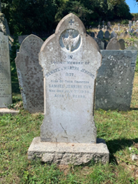
A wonderful image of Samuel can be seen below (you can make your own minds up!):
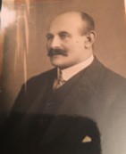
I wanted to take the opportunity to use the library’s photo archive and its vast collection of reference material to further illustrate the working lives of people on the Isles of Scilly during the late 19th and early 20th century.
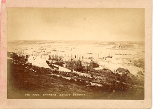
Samuel was born in 1858 on St. Mary’s, Isles of Scilly. He was raised by his grandparents Samuel and Martha Jenkins. He was later entombed with them both after his own death on July 7th 1930. The image below illustrates what Hugh Town, St Mary’s looked like during Samuel’s childhood and early adulthood.
Print of St. Marys, Hugh Town
Now Samuel’s life story has been immortalised by the people of Scilly… but sadly not for the right reasons. In a passage called “Old Sam” in the book, The Cassiterides: My Lovely Islands, Lis Hargreaves described the man as having “The reputation of being the biggest rascal of them all” and that after his death, his ex-wife regarded his burial under an Australian Yew tree as being fitting, as his afterlife would certainly be “down under.”
His reputation derived from ‘a notable career in and out of the local Courts of Justice. The charges were “minor” – like assault- and the magistrates were lenient as Scillonian tradition demanded ‘heavy fines on visiting crooks, leaving the local ones with a criminal record but no lasting charge of rates.’
This blog is not long enough to explore Samuel’s various criminal convictions. Instead, it is looking to understand his working life, and those of his Scillonian counterparts.
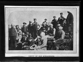
All surviving accounts show that Samuel was an agricultural labourer, which would have seen him work during the seasonal flower industry on the island. Due to the climate of the island, flowers such as cheesewood, speedwells, redclaws, spindle trees, arum lilies, and of course, the famous Isles of Scilly daffodils, all thrived. The collection of photos held by Morrab’s Photo Archive provides a vivid illustration of what the flower industry looked like on the island.
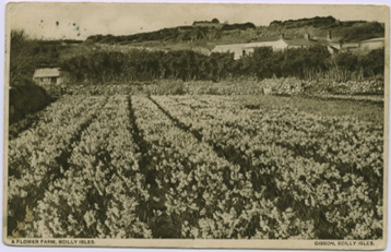
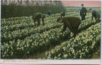
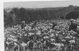
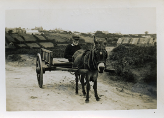
My great, great, great grandfather epitomised the idea of the ‘Economy of Makeshifts.’ This is a theory created by historians King and Tompkins and describes how labourers had to take on additional forms of employment to make up for poor wages.
This theory is relevant for the labourers of the Isles of Scilly, as, for survival on the islands, people had to adopt a range of different seasonal occupations to make ends meet. In The Cassiterides it was noted that ‘Sam sold fresh vegetables- sometimes in error on Sundays when he woke up and forgot which day it was and took the cart out of habit round Hugh Town.’
On the Islands, this would have seen people engaging in fishing, shipbuilding, kelp burning, construction, pilot-shipping, and other small-scale occupations, all to make ends meet.
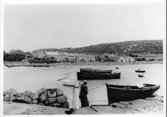
Fishing Boats in harbour
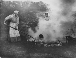
Kelp Burning on Farmland
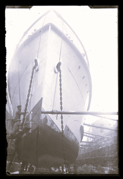
Men working on the hull of the Scillionian
He also demonstrated how dangerous “throwing yourself at any job” can be. It was reported in the Cornishman on June 15th 1905, that:
“On Monday morning whilst Samuel Jemkins Guy was at work in the Carn Thomas School playground, cleaving and blasting stone preparatory to the addition of a new wing to the school, a portion of a charge of dynamite (which had failed to explode with the remainder of the charge fired on Friday) suddenly exploded in the stone on which he was standing, blowing him down…”
“In the Afternoon he was taken on a stretcher to the pier and sent across by the Lyonnness to Penzance, and later he left of the Royal Cornwall Infirmary, Truro.”
After this near-death event, it was noted in the The Cassiterides that Sam then started to believe in the afterlife as “for years he slept by the coffin he’d made ready for his last exit.”
…. Now, with this said, I want to thank my mum and dad for naming me after a man of such an interesting calibre.
Not only have they made it impossible to live up to such a name, but you have greatly inspired my interest in exploring both nefarious sorts and the working lives of our forebearers.
I shall leave you with the beautifully written description from The Cassiterides that states that the present-day generation of Guys “acknowledge Sam as a forebear of the family- rather like an over-size family skeleton in a coffin-shaped box.”
Bibliography
Primary Sources
Cornishman. June 15th ,1905.
Secondary Sources
Bowley, R.L. The Fortunate Islands: The Story of the Isles of Scilly. St. Marys, Isles of Scilly: Bowley Publications LTD, 1990.
Hargreaves, Lisa. The Cassiterides: My Lovely Islands. Truro: Mary’s Walls, 1977.