by Lisa Di Tommaso | Aug 22, 2026 | Blog, Images, Morrab Library, Photographic Archive
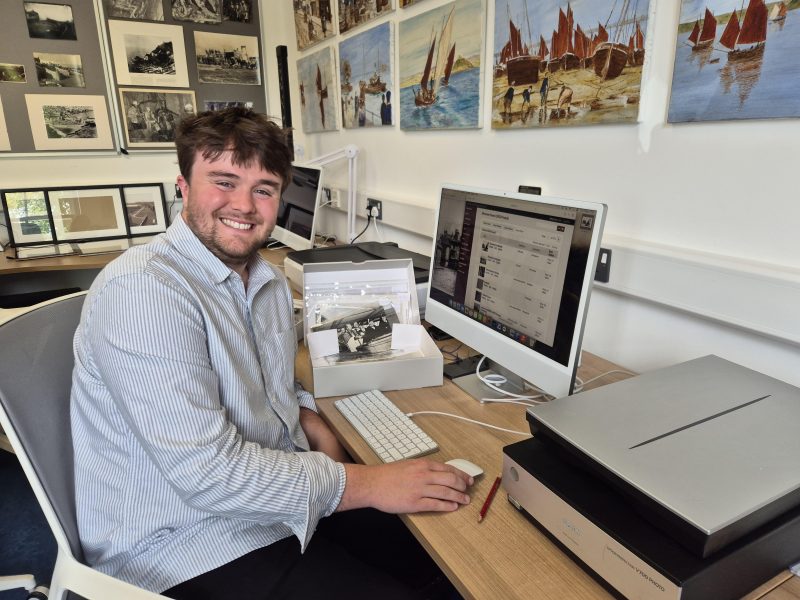
Our library was fortunate, and delighted, to host Sam Hill on a three month internship, where he worked in our Photo Archive.
As well as no less than seven blogs you can find links to below, and delivering an entertaining talk about his time with us and the discoveries he made in the collections, Sam has also written a longer academic paper about our collections, which we will add to our archive. This article explores West Cornwall’s maritime people and their working lives between 1865 and 1935, using images from our Photo Archive collections.
You can click on this link to read Sam’s article here: Exploring West Cornwall’s maritime people, by Sam Hill August 2026
Use these links to read Sam’s blogs:
An Introduction to Sam
Maritime Communities and meeting the Creatures of the Deep
Penzance Then and Now Part One: Market Jew Street and Chapel Street
Penzance Then and Now Part Two: Promenade and Alexandra Terrace
Penzance Then and Now Part Three: Alverton.
Penzance Then and Now Part Four: Pubs, Taverns and Inns
The working lives of the people of the Isles of Scilly explored through my third great grandfather Samuel Jenkins Guy.
We are so grateful to Sam for all of his hard work and great company while he was with us, and we wish him all the best for the future.
by Lisa Di Tommaso | Jul 26, 2026 | Blog, Images, Morrab Library, Photographic Archive
This week, I was looking through some brilliant pictures of the various occupations and livelihoods exhibited within the Morrab Library Photo Archive’s Working Lives book. It inspired me to undertake some research about the working lives of my family in the Isles of Scilly.
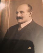
Although I was born, raised, and currently live in East Devon, my family heritage is deeply connected to the Isles of Scilly and West Cornwall. When I was born, my mum and dad wanted to honour the family connection to the Isles of Scilly by naming me after my third great-grandfather, Samuel Jenkins Guy.
The reason why is apparently we had the same head shape…
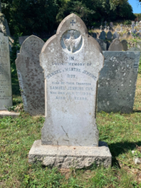
A wonderful image of Samuel can be seen below (you can make your own minds up!):
I wanted to take the opportunity to use the library’s photo archive and its vast collection of reference material to further illustrate the working lives of people on the Isles of Scilly during the late 19th and early 20th century.
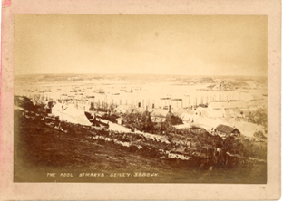
Samuel was born in 1858 on St. Mary’s, Isles of Scilly. He was raised by his grandparents Samuel and Martha Jenkins. He was later entombed with them both after his own death on July 7th 1930. The image below illustrates what Hugh Town, St Mary’s looked like during Samuel’s childhood and early adulthood.
Print of St. Marys, Hugh Town
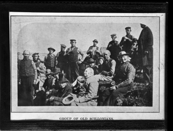
Now Samuel’s life story has been immortalised by the people of Scilly… but sadly not for the right reasons. In a passage called “Old Sam” in the book, The Cassiterides: My Lovely Islands, Lis Hargreaves described the man as having “The reputation of being the biggest rascal of them all” and that after his death, his ex-wife regarded his burial under an Australian Yew tree as being fitting, as his afterlife would certainly be “down under.”
His reputation derived from ‘a notable career in and out of the local Courts of Justice. The charges were “minor” – like assault- and the magistrates were lenient as Scillonian tradition demanded ‘heavy fines on visiting crooks, leaving the local ones with a criminal record but no lasting charge of rates.’
This blog is not long enough to explore Samuel’s various criminal convictions. Instead, it is looking to understand his working life, and those of his Scillonian counterparts.
All surviving accounts show that Samuel was an agricultural labourer, which would have seen him work during the seasonal flower industry on the island. Due to the climate of the island, flowers such as cheesewood, speedwells, redclaws, spindle trees, arum lilies, and of course, the famous Isles of Scilly daffodils, all thrived. The collection of photos held by Morrab’s Photo Archive provides a vivid illustration of what the flower industry looked like on the island.
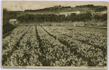
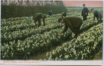
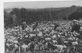
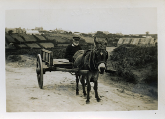
My great, great, great grandfather epitomised the idea of the ‘Economy of Makeshifts.’ This is a theory created by historians King and Tompkins and describes how labourers had to take on additional forms of employment to make up for poor wages.
This theory is relevant for the labourers of the Isles of Scilly, as, for survival on the islands, people had to adopt a range of different seasonal occupations to make ends meet. In The Cassiterides it was noted that ‘Sam sold fresh vegetables- sometimes in error on Sundays when he woke up and forgot which day it was and took the cart out of habit round Hugh Town.’
On the Islands, this would have seen people engaging in fishing, shipbuilding, kelp burning, construction, pilot-shipping, and other small-scale occupations, all to make ends meet.
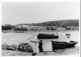
Fishing Boats in harbour
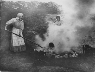
Kelp Burning on Farmland
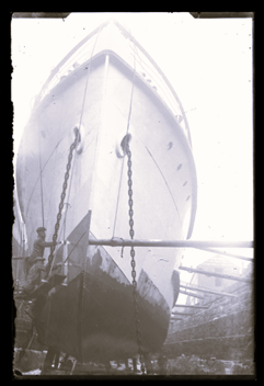
Men working on the hull of the Scillionian
He also demonstrated how dangerous “throwing yourself at any job” can be. It was reported in the Cornishman on June 15th 1905, that:
“On Monday morning whilst Samuel Jemkins Guy was at work in the Carn Thomas School playground, cleaving and blasting stone preparatory to the addition of a new wing to the school, a portion of a charge of dynamite (which had failed to explode with the remainder of the charge fired on Friday) suddenly exploded in the stone on which he was standing, blowing him down…”
“In the Afternoon he was taken on a stretcher to the pier and sent across by the Lyonnness to Penzance, and later he left of the Royal Cornwall Infirmary, Truro.”
After this near-death event, it was noted in the The Cassiterides that Sam then started to believe in the afterlife as “for years he slept by the coffin he’d made ready for his last exit.”
…. Now, with this said, I want to thank my mum and dad for naming me after a man of such an interesting calibre.
Not only have they made it impossible to live up to such a name, but you have greatly inspired my interest in exploring both nefarious sorts and the working lives of our forebearers.
I shall leave you with the beautifully written description from The Cassiterides that states that the present-day generation of Guys “acknowledge Sam as a forebear of the family- rather like an over-size family skeleton in a coffin-shaped box.”
Bibliography
Primary Sources
Cornishman. June 15th ,1905.
Secondary Sources
Bowley, R.L. The Fortunate Islands: The Story of the Isles of Scilly. St. Marys, Isles of Scilly: Bowley Publications LTD, 1990.
Hargreaves, Lisa. The Cassiterides: My Lovely Islands. Truro: Mary’s Walls, 1977.
by Lisa Di Tommaso | Jul 19, 2026 | Blog, Images, Morrab Library, Photographic Archive
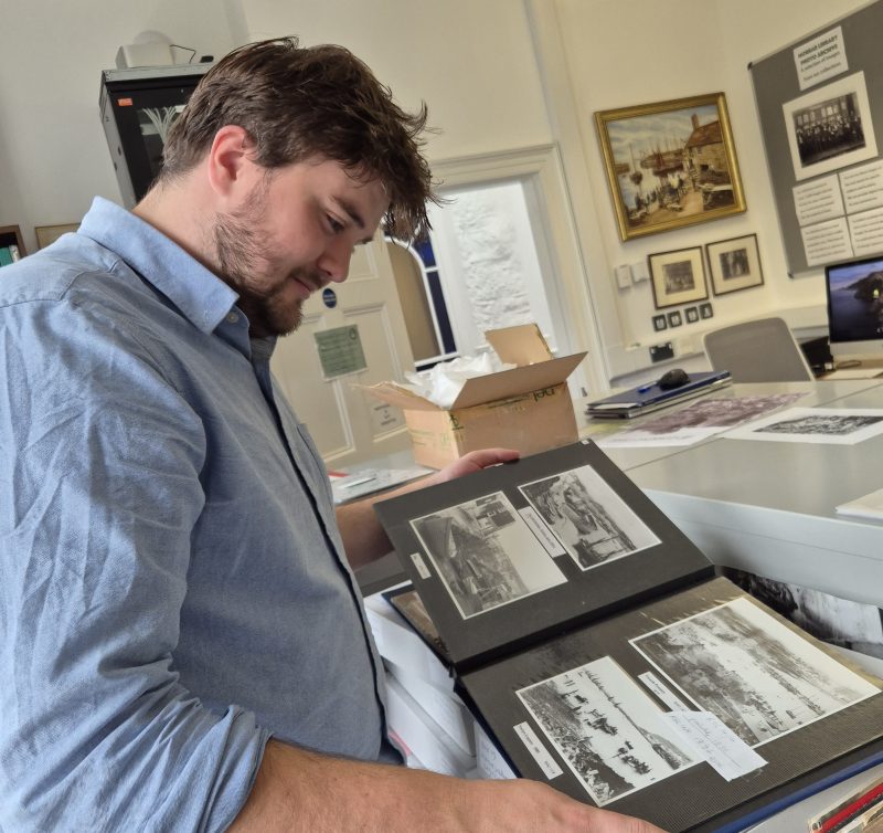
Join our Photo Archive intern, Sam Hill for his fourth blog, written during his time with us…
In our fourth instalment of the “Penzance Then and Now” blog post series, I shall be exploring some of the history of Penzance’s Pubs, Taverns, and Inns. When I was researching the last three blogs, I came across a great selection of images that show the historic nature of the town’s drinking spots.
It must be noted that not all the town’s drinking establishments are respresented in the Morrab’s collections, so if you do possess any historic images of these places please do get in contact with the Photo Archive team, as we would love to preserve them.
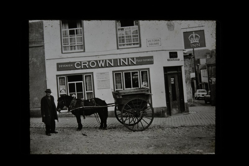
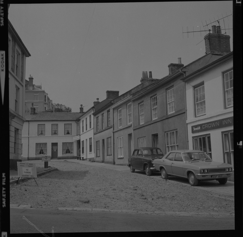
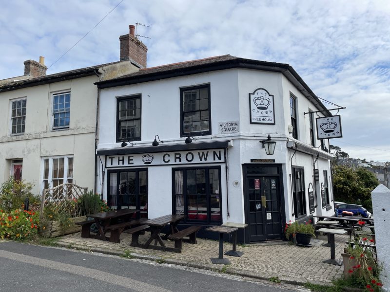
The Crown Inn
The Crown Inn has been designated as a Grade II listed building due to the early 19th century stucco style visible on the building. It is located on Victoria Square, which was constructed in 1829.
The Navy Inn
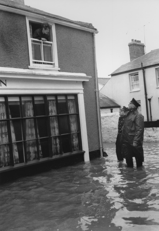
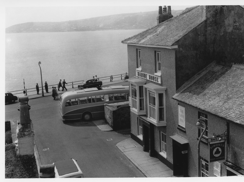
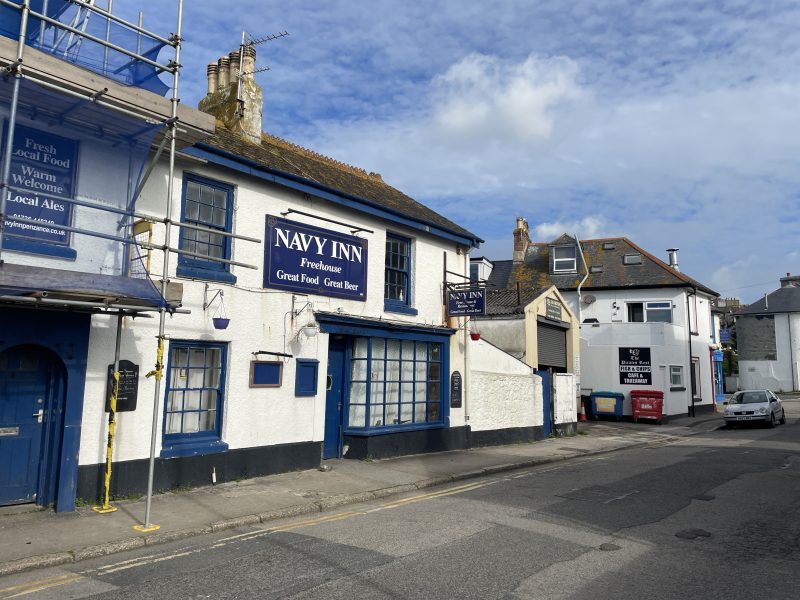
Located near the bottom of Queen Street, the Navy Inn is a 19th century building made from granite and stone. The name of the Inn derives from when the Royal Navy maintained a local depot nearby. The Inn is adjacent to Marine Place, the notorious location of the Marine Place murders in 1886 by James Hawke. The image below show the pub during the Ash Wednesday floods of 1962.
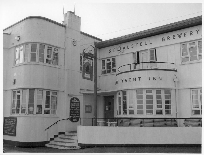
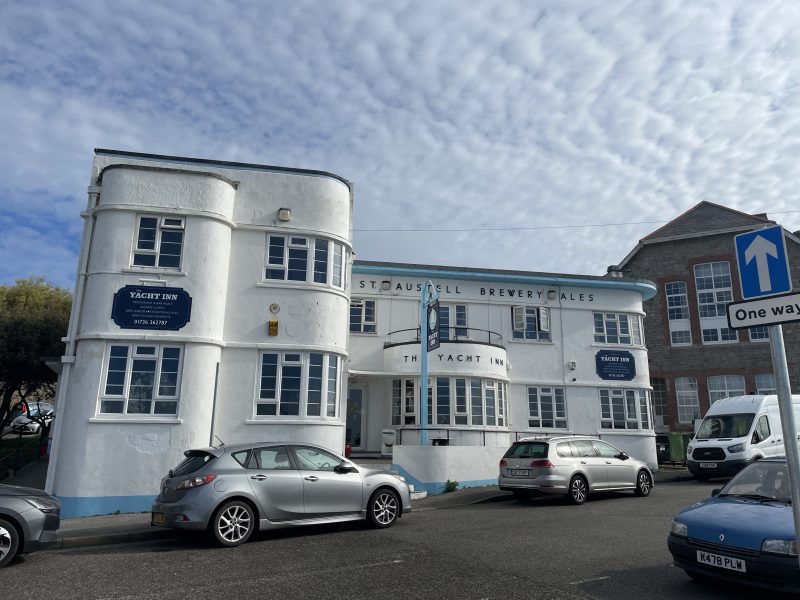
The Yacht Inn
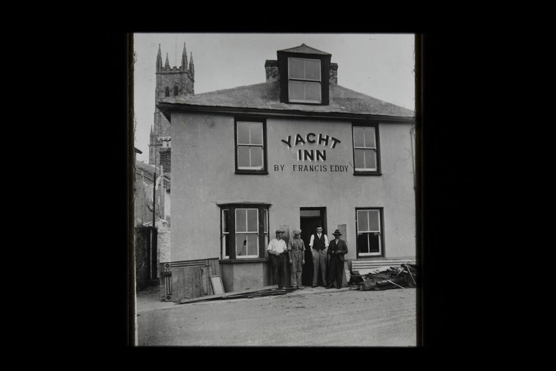
The images below show both iterations of the Yacht Inn. The first photo shows the original building, which was a notable drinking spot for the seaweed gatherers of the town. After the construction of the Jubilee Pool in 1935, the Yacht Inn reopened with a new structure designed by Collins Minor Drewitt to resemble a bridge of a luxury cruiser.
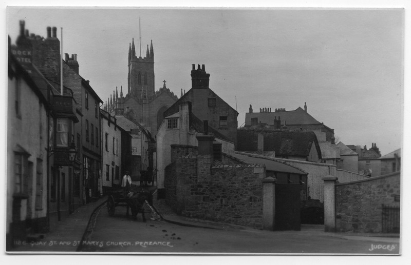
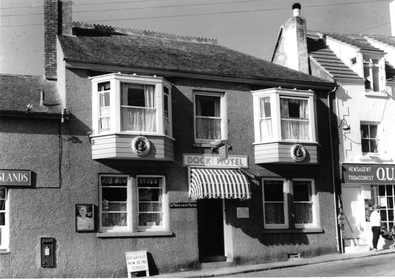
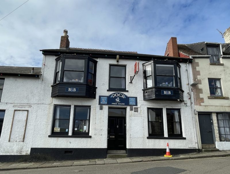
The Dock Inn
Located at the bottom of Quay Street, the Dock Inn is an historic pub and B&B that has stood on the quay since the 18th century. It would have been a popular drinking spot for the sailors, fishermen, and townsfolk of old.
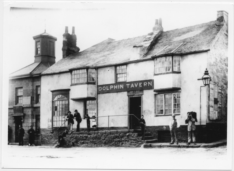
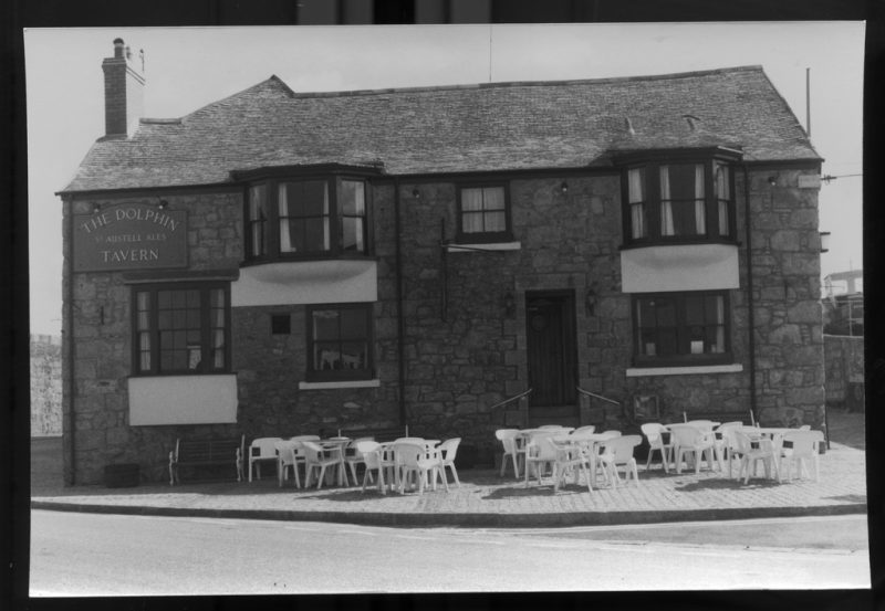
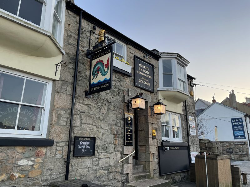
The Dolphin Tavern
One of Penzance’s most famous pubs, the Dolphin Tavern has a long and fascinating history. A building has been present on site since the 14th century, firstly being used as a recruitment centre by Vice Admiral John Hawkin before the Spanish Armada, and later, a local courthouse. The infamous Judge Jeffreys handed out severe sentences against smugglers and other criminals, with the ‘hanging room’ located in the basement. The tavern has reported numerous supernatural apparitions, with a young fair-haired man, a young Victorian woman, and a sea captain called George being seen.
The Turks Head
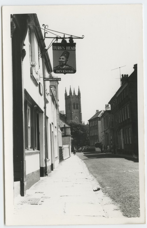
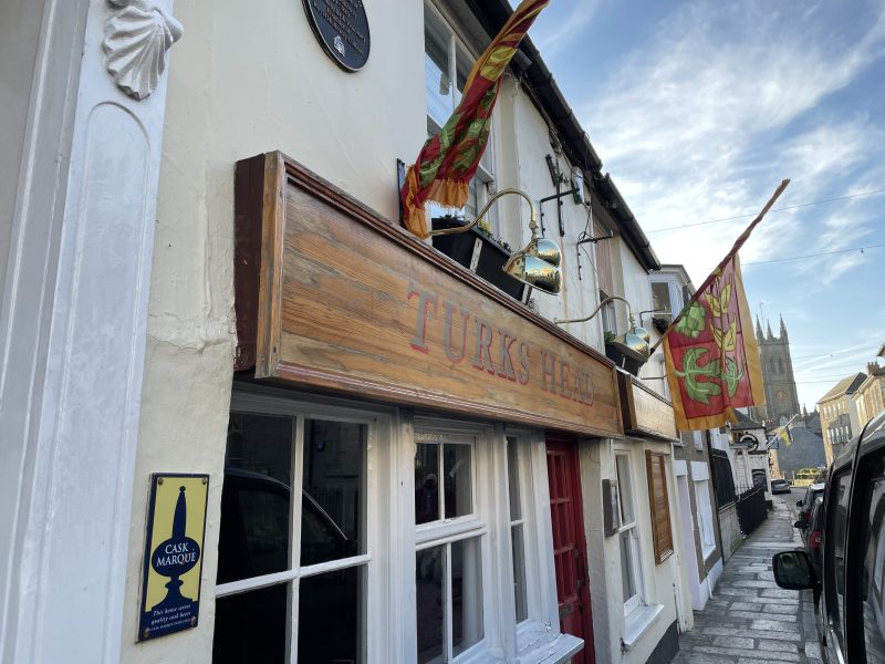
Supposedly the oldest pub within the town, the Turks Head is one of the first in England to bear its name after the Saracens, whom Christian Knights fought in the Crusades. After the Spanish burnt down most of Chapel Street during their Raid on Penzance in 1595, the Turks Head was one of the few stone buildings to have survived the blaze.
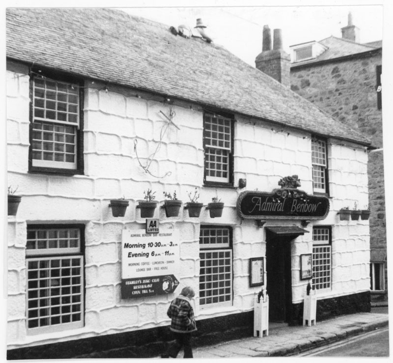
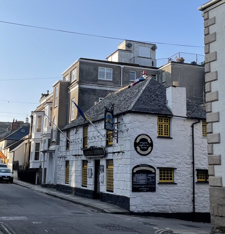
The Admiral Benbow
This pub was built by local legend and maritime salvager, Roland Morris, by combining two old cottages. The pub is home to an array of nautical paraphernalia, including ship figureheads, lanterns, and flint lock pistols. Local legend says that when it was a sailor’s rest during the 18th century, the building supposedly possessed an underground tunnel that ran down to the harbour to allow smugglers to move contraband product. One of the armed smugglers has been immortalised on the roof of the pub.
The Pirate Inn
The Pirate Inn on Alverton Road was originally a traditional farmhouse built either in 1674 or in 1701. These dates are known from two dates carved directly into the stonework. The building did not become a public house until 1953, in which the name of the pub most likely derived from Gilbert and Sullivan’s comic opera The Pirates of Penzance.
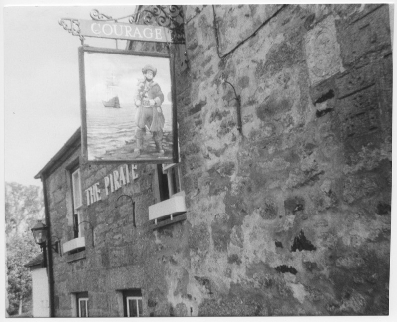
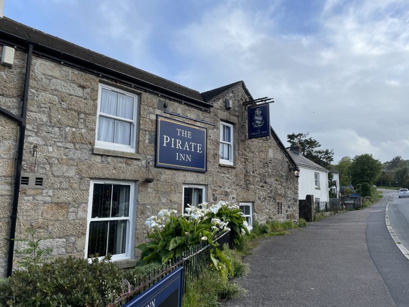
I hope you have enjoyed this visual pub crawl of some of the pubs of Penzance!
All the photos used in this post are accessible from the Morrab Library’s Photographic Archive, the link to which is here: https://photoarchive.morrablibrary.org.uk/
by Lisa Di Tommaso | Jul 12, 2026 | Blog, Images, Photographic Archive
Join our Photo Archive intern, Sam Hill for his latest blog, written during his time with us…
In the third instalment of the “Penzance Then and Now” series, I shall be using the Morrab’s Photo Archive Collection and some contemporary images for comparison to explore the history of Alverton on Penzance’s western side.
The area of Alverton has a long history, first being named within the Domesday Book of 1086, when the manor of Alverton was owned by a Saxon called Alward. The name Alverton stems from the name ‘Alward’ and the ‘tun’ meaning town or important settlement.
Hawkes Farm is a notable building along the road, with the farmhouse being in constant use throughout the 18th and 19th centuries. The name of the farm derives from Richard Hawke, a flour storekeeper, who lived there with his wife and son in 1841.
One of the most notable residents at Hawkes Farm was Samuel Pellow, whose family moved to Penzance in 1746. Pellow or later the Admiral Lord Exmouth had a longstanding career in the British Navy and saw action in conflicts during the French Revolutionary Wars. He was portrayed by Robert Lindsay in the late 1990s television show Hornblower.

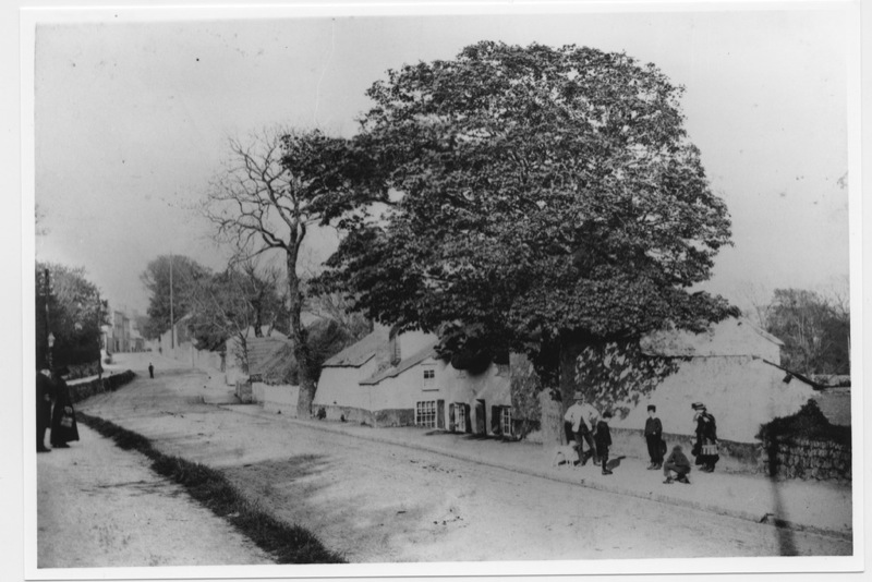

Images 1,2,3
Polwithen Lodge was built to serve the nearby Polwithen House, which was built in 1870 by William Bolitho. The house was home to the gardener of the grounds, and recent discoveries have unearthed an underground tunnel that connected to the cellar of the Lodge and Polwithen house. This would have been used in the daily commercial and domestic lives of the Bolitho family.
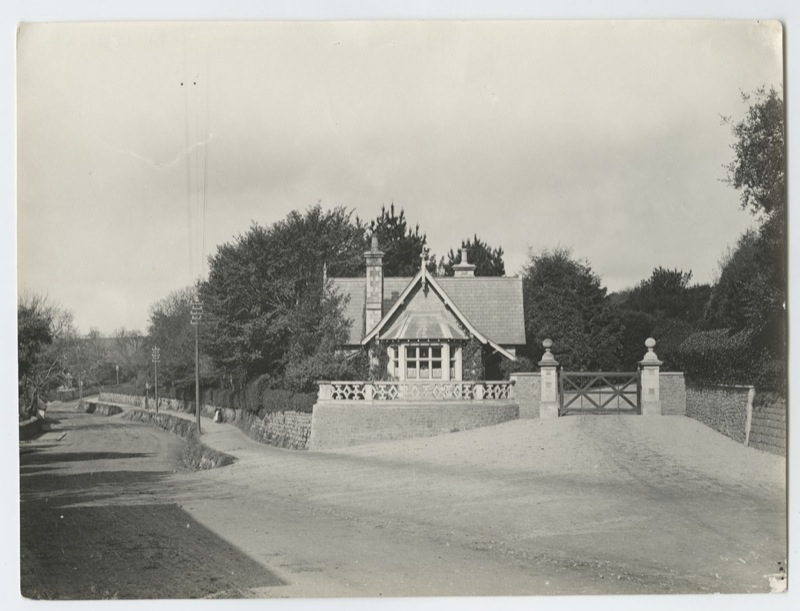

Images 4 and 5
The area of Alverton starts at the First and Last Inn, which served as a carrier’s and jaunting car house, serving the Royal Mail Coaches and travellers to the Land’s End and the surrounding area.
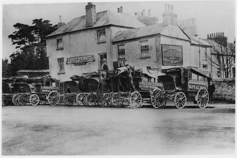

Images 6 and 7
For most of Alverton’s history, the area had been open countryside with a few cottages and farms seen along the lane out of Penzance. The land on the North side of Alverton Road was referred to as Alvern-Weith or Alvern-Weeth. This was due to the number of willow trees that were being grown for the local production of basketwork.
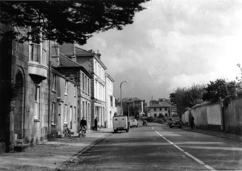
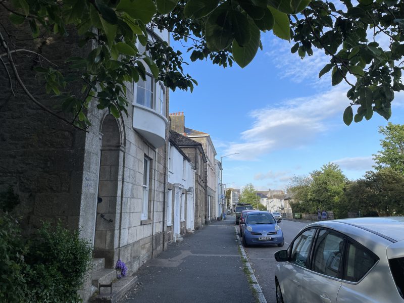
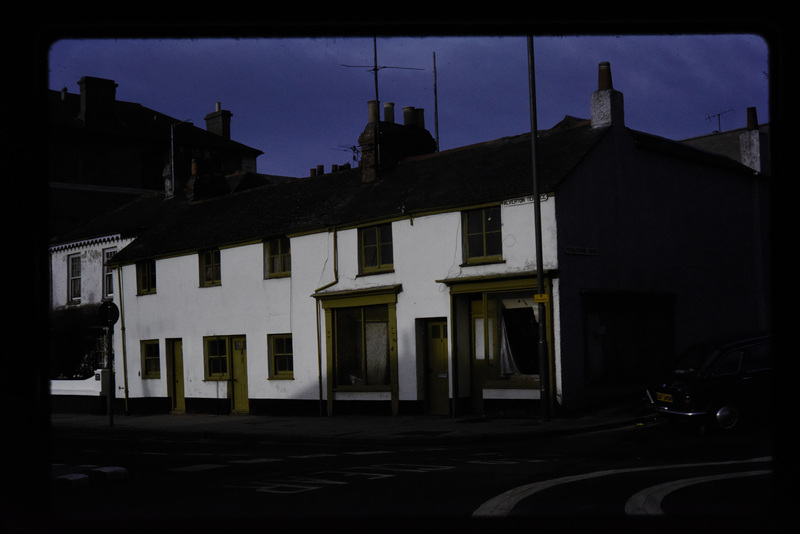
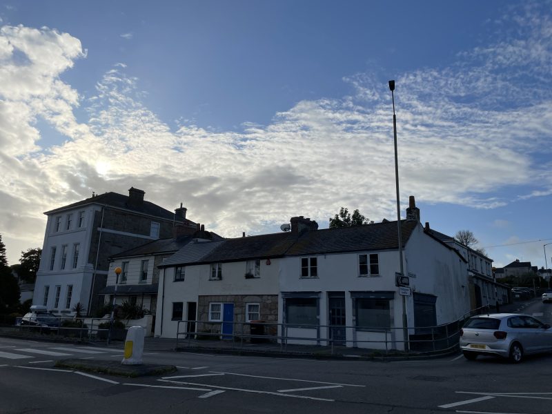
Images 8, 9, 10, and 11.
I hope that you have enjoyed this scenic look at Alverton. Its long history is too broad to detail in this blog, but if you are interested in seeing more, please use the Morrab Photographic Archive, using this link: https://photoarchive.morrablibrary.org.uk/
by Lisa Di Tommaso | Jun 24, 2026 | Blog, Images, Morrab Library, Photographic Archive
Join our Photo Archive intern, Sam Hill for his latest blog, written during his time with us…
In the second instalment of the “Penzance Then and Now” series, I shall be using the Morrab Photo Archive Collection and some contemporary images for comparison to explore the history of the Promenade and Alexandra Road.
During the late 19th and early 20th century, Penzance faced an immense period of change. Enlargements to the harbour in 1825, the building of the new Market House in 1838 and the construction of the Public Buildings in 1867 were notable changes to the town. The seafront underwent the grandest changes, as the arrival of the railway and tourism led to the construction of both the Promenade in 1844 and Alexandra Road in 1865. These changes drastically altered the economic focus and social conditions of the town.
Alexandra Road was designed by 1865 by John Matthews, with the aim that it would connect Alverton to the Sea. It was opened by the Prince of Wales later in the same year. The road opened with a pair of houses, which later became the Beachfield Hotel.
After the destruction of the cottages on the opposite side of the road to the Beachfield hotel, the ornate ‘Bijou house’ was built in 1880 by Sidney Wright and was later demolished in 1950. This is now where Wherrytown car park is.
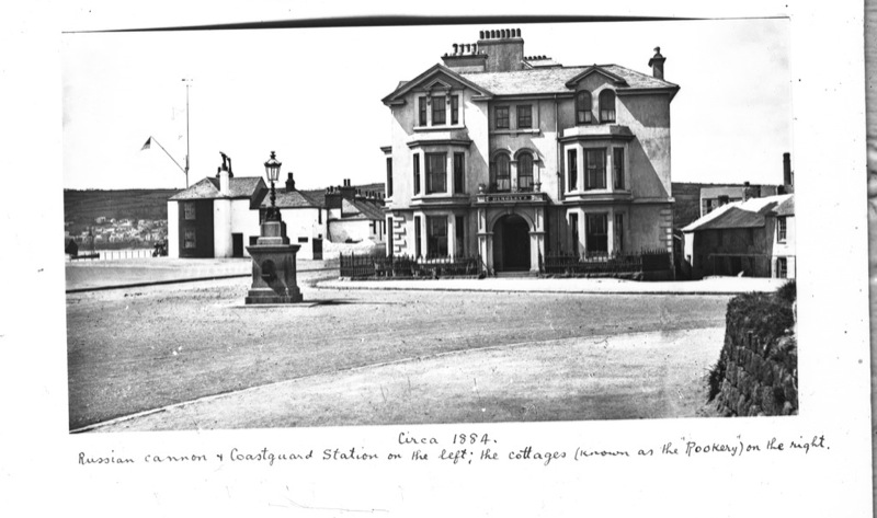
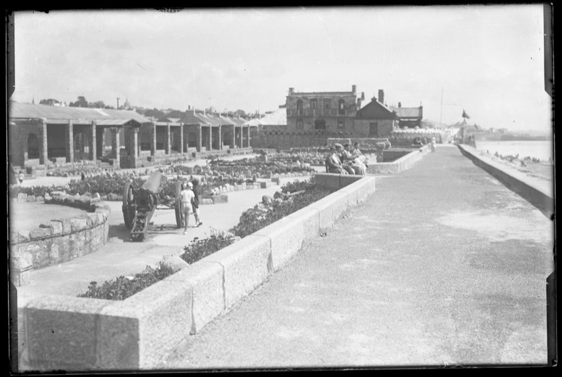
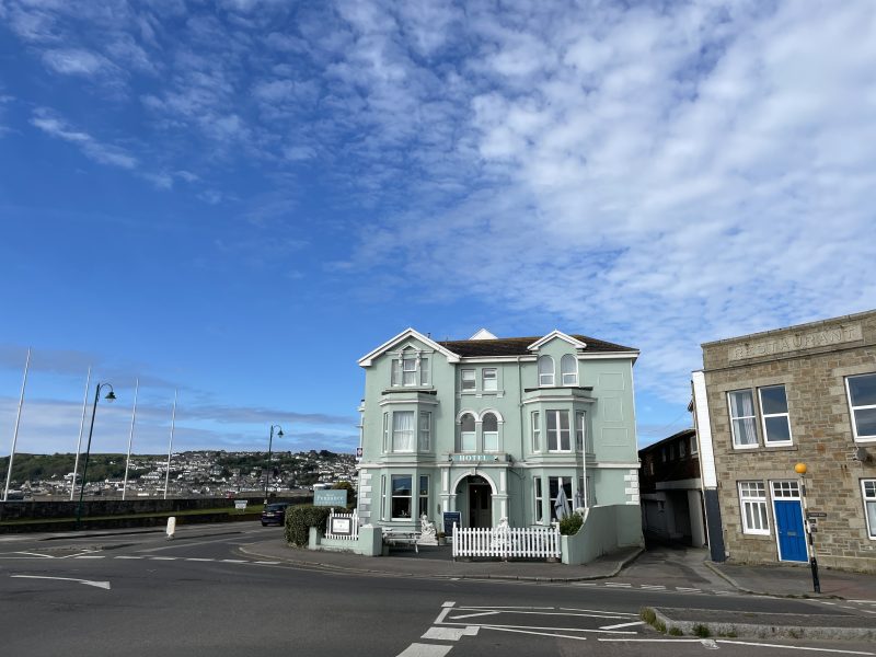
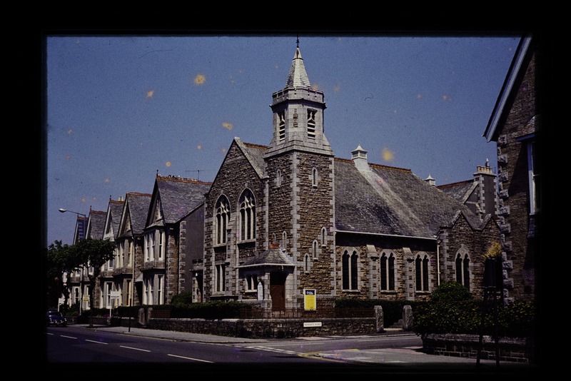
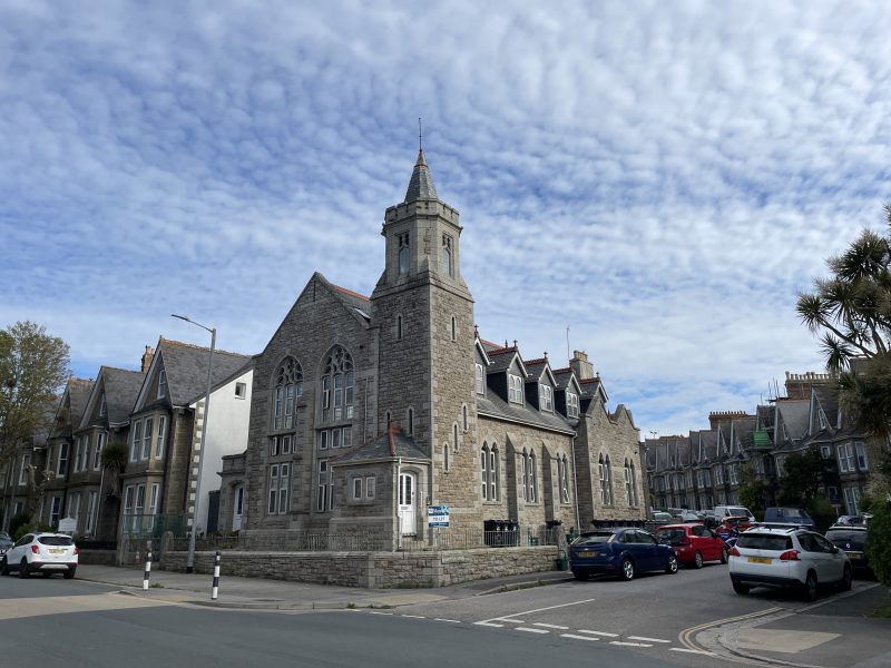
It was later in July of 1903 that the Alexandra Grounds were opened on the promenade, with the area being a designated ‘green space’ for the town. By the 1920s, a bowling green and a tennis court were built next to the St. Mary’s Church of England School. The spaces around the road eventually became the rugby pitch, Mennaye fields in 1934 and the Rotary Boating Lakes in 1955.
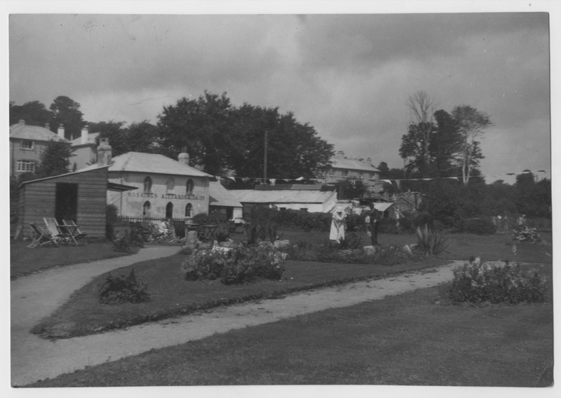
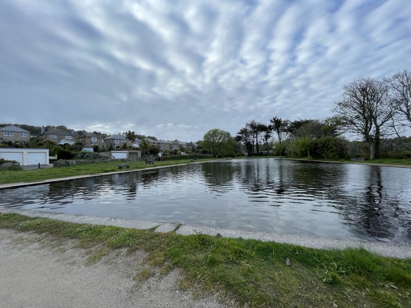
The Pavilion (now the arcade) was built in 1911 to serve the flourishing tourist industry. It held a restaurant, theatre, and ballroom. During the Second World War, concert parties were held within the building to keep wartime morale high.
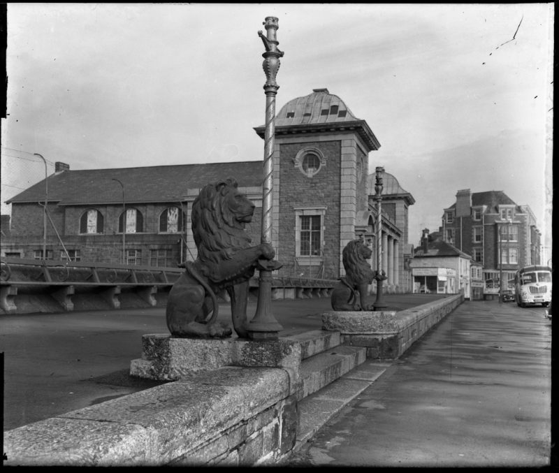
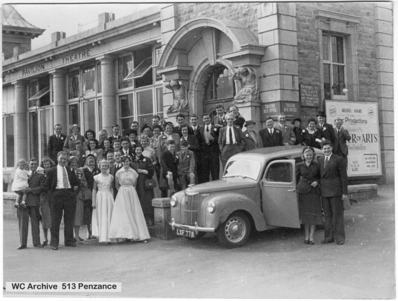
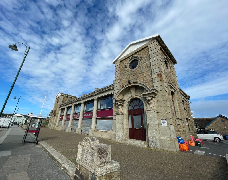
The construction of the promenade or Marine Esplanade in 1844 drastically changed the vision of the town’s industry, as the space now catered for a tourism trade brought about by the Cornish Riviera trainline. The occupation of such space was a facet in the diminishment of the local fishing industry
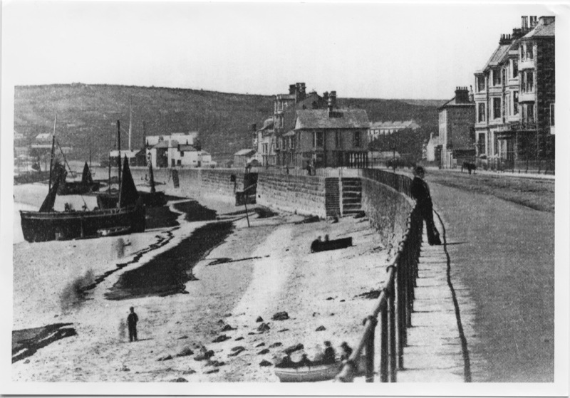
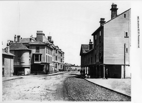
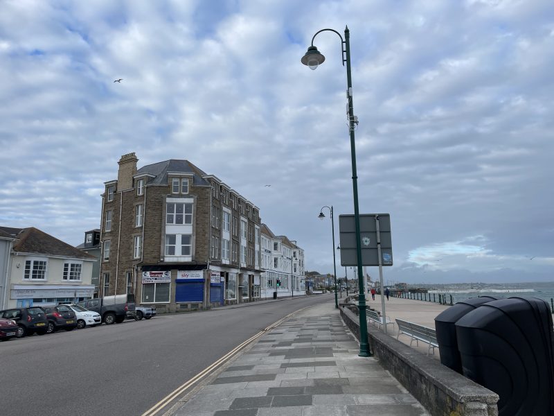
Both the Mounts Bay Hotel and the Queen’s Hotel were built to accommodate the tourist trade brought about by the train line from Penzance to London. The buildings were constructed in the 1860s.
The construction of the Bathing pool, now Jubilee Pool on Battery Rocks in 1935 was one of the first achievements of the reconstructed town council. The pool was built with a distinctive Art Deco style.
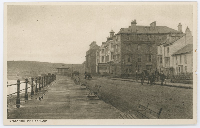
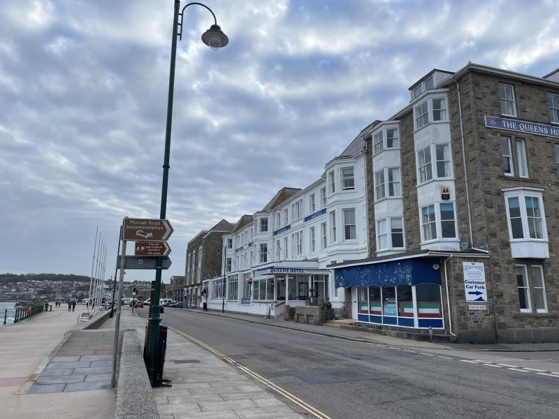
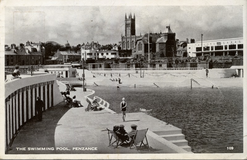
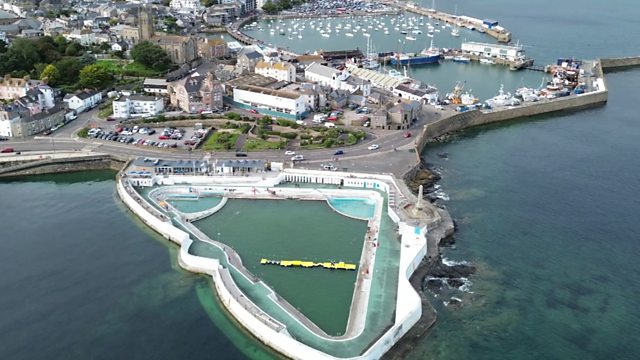
I hope this blog has infused you with a great summer feeling and that it has brought back fond memories of times“promenading” along the seafront. These photos are incredibly useful for understanding how tourism and leisure changed the physical landscape, economic focus, and social conditions within Penzance.
More photos of the promenade, the town centre, the harbour, and everything in between are available on the photo archive online collection, the link to which is here: https://photoarchive.morrablibrary.org.uk/
by Lisa Di Tommaso | Jun 14, 2026 | Blog, Images, Morrab Library, Photographic Archive
Join our Photo Archive intern, Sam Hill for his latest blog, written during his time with us…
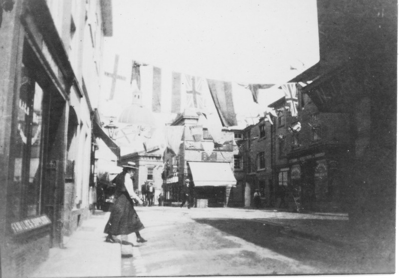
During my time exploring the Morrab Library’s Photo Archive, I have come across so many wonderful pictures of Penzance that can truly transport you back in time. As such, I thought it would be worthwhile to write the “Penzance Then and Now” blog post series, which will explore snippets of the town’s history using the library’s photo archive collections and some contemporary images I have taken for comparison. In our first instalment, I shall display a range of photos that show the history of Market Jew Street and Chapel Street.
Walking up Market Jew Street is often a daily occurrence for the people of Penzance, with its cafes, shops, and pubs being frequented by locals. The street’s name, “Market Jew Street,” derives from the Cornish words for market, marghas, and Thursday, yow, which together made marghas yow and thus “Thursday Market.”
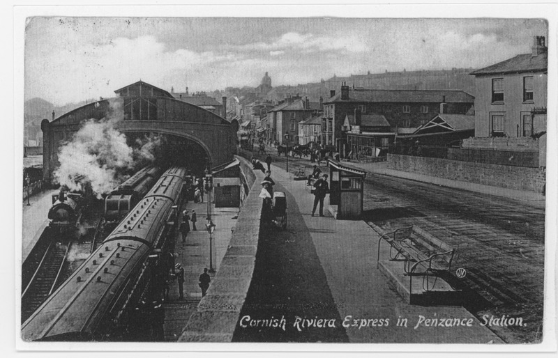
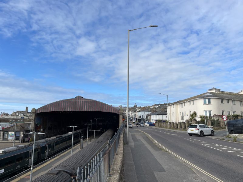
Image 1 and 2- Train station looking up towards Market Jew Street
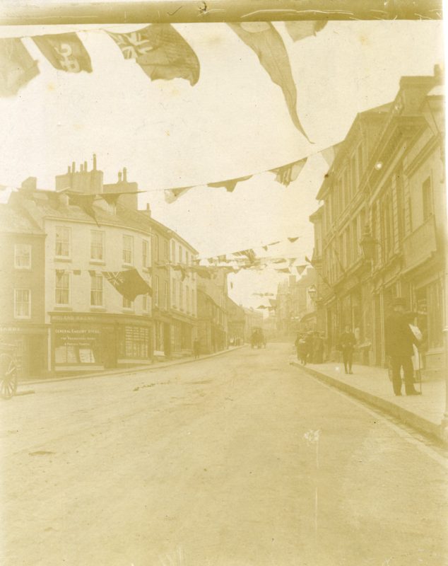

Image 3 and 4- Albert Street looking up towards Market Jew Street https://photoarchive.morrablibrary.org.uk/items/show/22673
At the top of the street, the Market House towers over the main artery of Penzance. The space has been occupied by a market house and a guildhall since the Penzance Corporation bought the three-cornered plot of waste land in 1614.
The current Market House is a replacement of the 17th-century counterpart, as the town’s corporations wanted to replace the old and inadequate building. The new Market House was the product of an architectural competition held by the New Corporation in 1835. The winner was H. J. Whiting, but the commission was given to William Harris. The building took two years to build and was officially opened by the Mayor, Richard Pearce, on 28th June 1838, on the day of Queen Victoria’s Coronation.

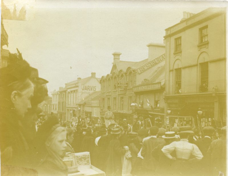
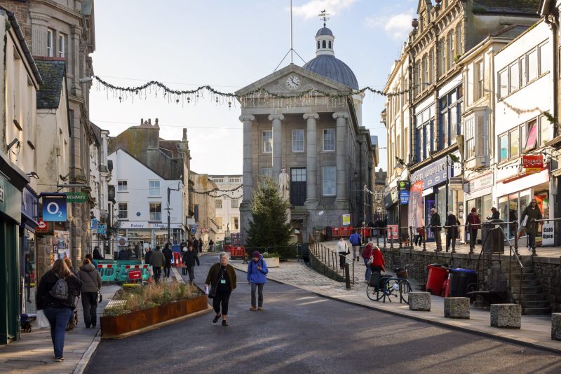
Image 5, 6 and 7- Around the top of Market Jew Street – https://photoarchive.morrablibrary.org.uk/items/show/22829 / https://photoarchive.morrablibrary.org.uk/items/show/22789
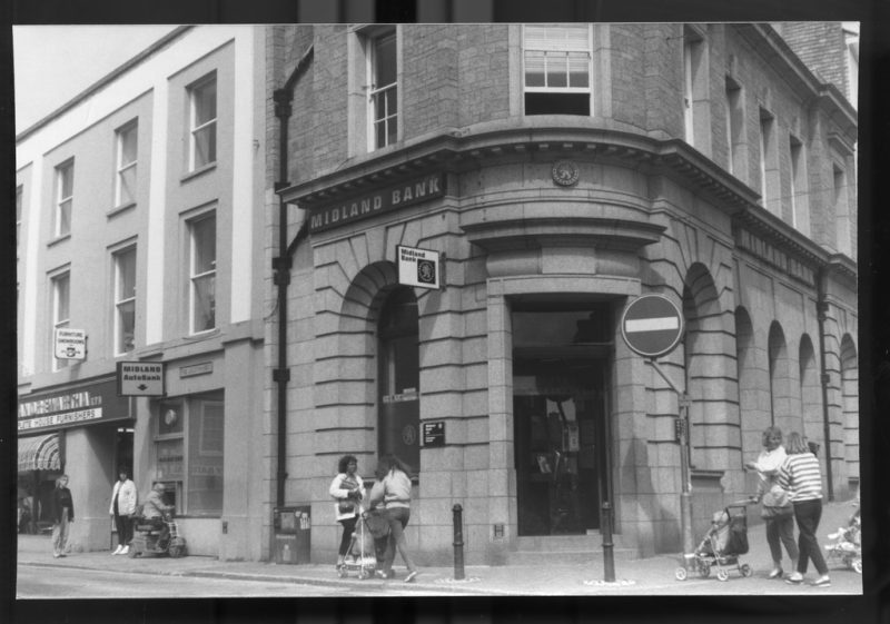

Images 8 and 9

Images 10 and 11
The adjoining street, “Chapel Street”, derives from the Chapel of St. Mary, not from the Methodist Chapel erected on the street in 1814, which is often assumed. The street is named as “Our Lady Street” in 1549 and “Lady Street” in 1665.
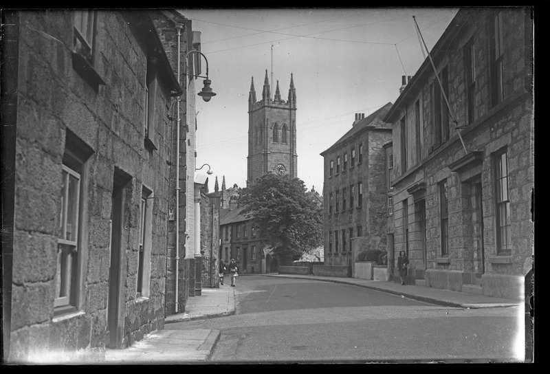
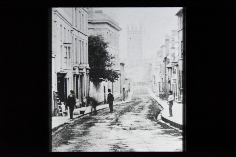

Image 12, 13 and 14
In the 18th century, the street began to reflect the period of steady growth of the town through the construction of various attractive buildings. These buildings were unique for the area as they were built in brick with granite dressings, with good examples being No.15 “Crownley”, No.16 “Trevelyan Hotel”, No.18, No.19, No.20 and No.45.
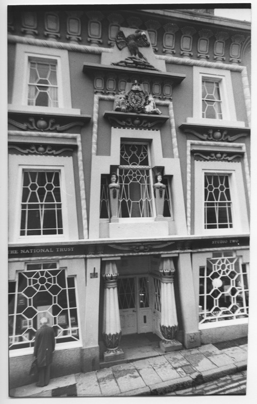
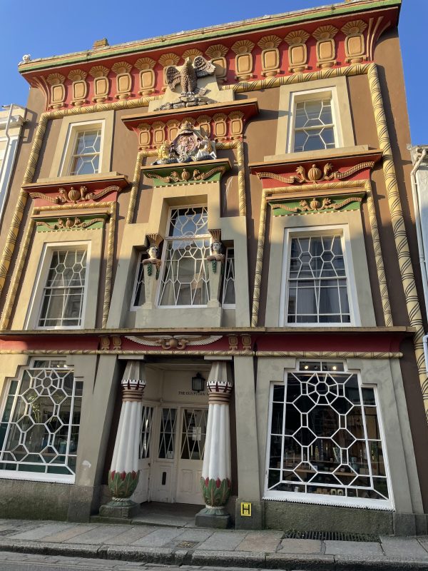
Image 15 and 16
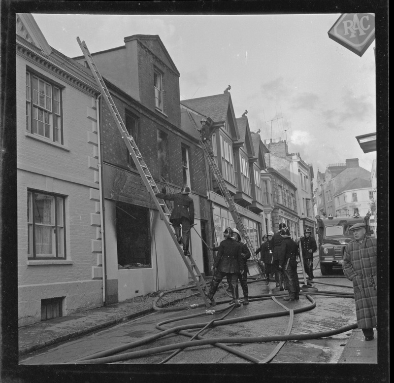

Image 17 and 18
Much of Chapel Street building was undertaken in the latter 18th century, but the main front of the Union Hotel is early- 19th century stucco, with fluted Ionic pilasters and volutes. Nowadays, Chapel Street is one of the many jewels of Penzance, and is the home of a range of amazing shops, pubs and eateries.
I hope you have enjoyed looking through some of the amazing photos of Penzance held at the Morrab Library. It is impossible to cover all the areas of Penzance, but if there is a place you are particularly interested in, then please do contact the Morrab Library Photographic Archive collection or visit the website to search the archive online: https://photoarchive.morrablibrary.org.uk/